
Thank you for supporting this site ❤️
Make a donation
Make a donation
Gear up for your next adventure:
As an Amazon Associate, this site earns from qualifying purchases at no extra cost to you.
Haan topographic map
Click on the map to display elevation.
Thank you for supporting this site ❤️
Make a donation
Make a donation
Gear up for your next adventure:
As an Amazon Associate, this site earns from qualifying purchases at no extra cost to you.
About this map
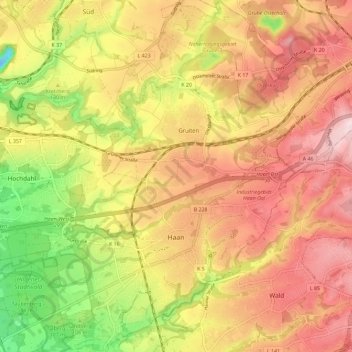
Name: Haan topographic map, elevation, terrain.
Location: Haan, Kreis Mettmann, North Rhine-Westphalia, 42781, Germany (51.17194 6.95940 51.24411 7.05175)
Average elevation: 489 ft
Minimum elevation: -49 ft
Maximum elevation: 850 ft
Thank you for supporting this site ❤️
Make a donation
Make a donation
Gear up for your next adventure:
As an Amazon Associate, this site earns from qualifying purchases at no extra cost to you.