
El Porté topographic map
Interactive map
Click on the map to display elevation.
About this map
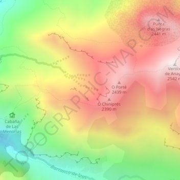
Name: El Porté topographic map, elevation, terrain.
Location: El Porté, Canfranc, La Jacetania, Huesca, Aragão, Espanha (42.76109 -0.48811 42.78109 -0.46811)
Average elevation: 6,545 ft
Minimum elevation: 4,544 ft
Maximum elevation: 8,343 ft