
Municipio Tarija topographic map
Interactive map
Click on the map to display elevation.
About this map
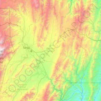
Name: Municipio Tarija topographic map, elevation, terrain.
Location: Municipio Tarija, Provincia Cercado, Tarija, Bolivia (-21.86902 -65.01164 -21.23756 -64.33172)
Average elevation: 7,031 ft
Minimum elevation: 3,022 ft
Maximum elevation: 13,898 ft