
Rojas topographic map
Interactive map
Click on the map to display elevation.
About this map
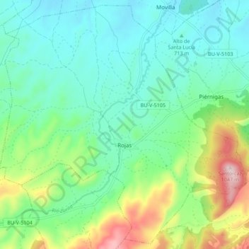
Name: Rojas topographic map, elevation, terrain.
Location: Rojas, Burgos, Castile and León, Spain (42.55374 -3.48420 42.61270 -3.40066)
Average elevation: 2,480 ft
Minimum elevation: 2,139 ft
Maximum elevation: 3,412 ft