
Hornindal topographic map
Interactive map
Click on the map to display elevation.
About this map
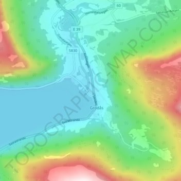
Name: Hornindal topographic map, elevation, terrain.
Location: Hornindal, Volda, Møre og Romsdal, 6763, Noruega (61.95030 6.50248 61.99030 6.54248)
Average elevation: 846 ft
Minimum elevation: 161 ft
Maximum elevation: 2,644 ft