Geolocate

Creixomil topographic map

Click on the map to display elevation.

About this map

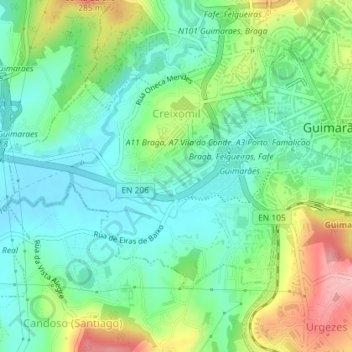
Name: Creixomil topographic map, elevation, terrain.

Location: Creixomil, Guimarães, Braga, Portugal (41.42935 -8.32912 41.44673 -8.29837)

Average elevation: 604 ft

Minimum elevation: 459 ft

Maximum elevation: 896 ft

Other topographic maps

Click on a map to view its topography, its elevation and its terrain.

Guimarães

Portugal > Braga > Guimarães

Average elevation: 981 ft

Além

Portugal > Braga > Guimarães > Sande (Vila Nova)

Average elevation: 472 ft

Gear up for your next adventure:

🛰️Satellite Messengers - Emergency SOS and two-way messaging for off-grid adventures
🔥Plasma Lighters - Windproof lighters that work in any weather condition
🪑Portable Camp Table - Compact table for campsite meals
🏥Hiking First Aid Kits - Comprehensive medical kits for remote trail injuries
🖼️Topo Map Wall Art - Decorative topographic prints of famous peaks and regions

As an Amazon Associate, this site earns from qualifying purchases at no extra cost to you.