Geolocate

Shotts topographic map

Click on the map to display elevation.

About this map

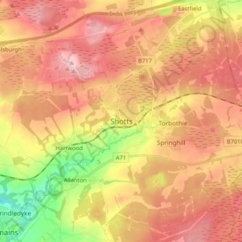
Name: Shotts topographic map, elevation, terrain.

Location: Shotts, North Lanarkshire, Scotland, ML7 4AW, United Kingdom (55.77967 -3.84732 55.85967 -3.76732)

Average elevation: 758 ft

Minimum elevation: 400 ft

Maximum elevation: 1,007 ft

Gear up for your next adventure:

🥾Women's Hiking Boots - Top-rated trail boots with ankle support and superior grip
🏕️Family Camping Gear - Essentials for group camping trips
🧣Hiking Neck Gaiter - Multi‑use neck protection for outdoor weather
🔌Solar Panel Charger - Charge gear sustainably outdoors
🦶Hiking Gaiters - Keep debris and water out of your boots

As an Amazon Associate, this site earns from qualifying purchases at no extra cost to you.