
Fairlight topographic map
Click on the map to display elevation.
About this map
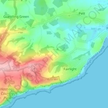
Name: Fairlight topographic map, elevation, terrain.
Location: Fairlight, Rother District, East Sussex, England, United Kingdom (50.86960 0.62260 50.89147 0.68333)
Average elevation: 154 ft
Minimum elevation: 0 ft
Maximum elevation: 558 ft
Other topographic maps
Click on a map to view its topography, its elevation and its terrain.
Bewl Water
United Kingdom > England > East Sussex > Rother District > Ticehurst
Average elevation: 302 ft