
Haute-Amance topographic map
Interactive map
Click on the map to display elevation.
About this map
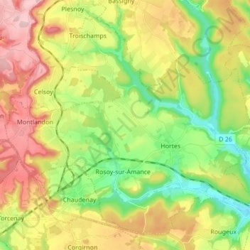
Name: Haute-Amance topographic map, elevation, terrain.
Average elevation: 1,089 ft
Minimum elevation: 797 ft
Maximum elevation: 1,457 ft
Other topographic maps
Click on a map to view its topography, its elevation and its terrain.
Troischamps
Frankrijk > Grand Est > Haute-Amance
Troischamps, Haute-Amance, Langres, Haute-Marne, Grand Est, Metropolitaans Frankrijk, 52600, Frankrijk
Average elevation: 1,070 ft