
North Tongu District topographic map
Interactive map
Click on the map to display elevation.
About this map
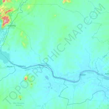
Name: North Tongu District topographic map, elevation, terrain.
Location: North Tongu District, Volta Region, Ghana (5.95487 0.09347 6.33378 0.50469)
Average elevation: 115 ft
Minimum elevation: -10 ft
Maximum elevation: 1,427 ft
Other topographic maps
Click on a map to view its topography, its elevation and its terrain.
Battor
Ghana > Volta Region > North Tongu District > Battor
Battor, North Tongu District, Volta Region, Ghana
Average elevation: 23 ft