
杨柳津河 topographic map
Interactive map
Click on the map to display elevation.
About this map
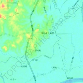
Name: 杨柳津河 topographic map, elevation, terrain.
Location: 杨柳津河, 河头村, 九合乡, 永修县, 九江市, 江西省, 中国 (29.10338 115.81136 29.15933 115.88832)
Average elevation: 72 ft
Minimum elevation: 33 ft
Maximum elevation: 226 ft