
Santuario topographic map
Interactive map
Click on the map to display elevation.
About this map
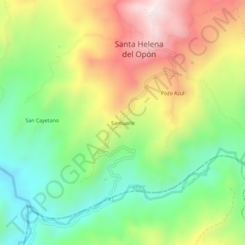
Name: Santuario topographic map, elevation, terrain.
Location: Santuario, Santa Helena del Opón, Vélez, Santander, Colombia (6.30672 -73.63901 6.34672 -73.59901)
Average elevation: 2,523 ft
Minimum elevation: 1,542 ft
Maximum elevation: 3,842 ft
Other topographic maps
Click on a map to view its topography, its elevation and its terrain.
La Fortuna
Colombia > Santander > Santa Helena del Opón
La Fortuna, Santa Helena del Opón, Vélez, Santander, RAP Gran Santander, Colombia
Average elevation: 3,458 ft