
Al Hamra topographic map
Interactive map
Click on the map to display elevation.
About this map
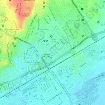
Name: Al Hamra topographic map, elevation, terrain.
Location: Banglore Town, Al Hamra, Karachi, Sindh, Pakistan (24.86754 67.08092 24.87341 67.08891)
Average elevation: 66 ft
Minimum elevation: 10 ft
Maximum elevation: 197 ft