
Llangefni topographic map
Interactive map
Click on the map to display elevation.
About this map
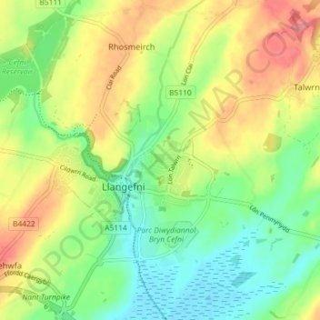
Name: Llangefni topographic map, elevation, terrain.
Location: Llangefni, Isle of Anglesey, Wales, United Kingdom (53.23806 -4.33380 53.28116 -4.27112)
Average elevation: 131 ft
Minimum elevation: 7 ft
Maximum elevation: 302 ft