
Tangkak topographic map
Interactive map
Click on the map to display elevation.
About this map
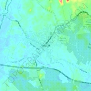
Name: Tangkak topographic map, elevation, terrain.
Location: Tangkak, Johor, 84900, Malaysia (2.22700 102.49996 2.30700 102.57996)
Average elevation: 69 ft
Minimum elevation: 10 ft
Maximum elevation: 489 ft
Other topographic maps
Click on a map to view its topography, its elevation and its terrain.
Kampung Anjung Batu
Kampung Anjung Batu, Tangkak, Johor, 84900, Malaysia
Average elevation: 52 ft