
Mirepoix topographic map
Interactive map
Click on the map to display elevation.
About this map
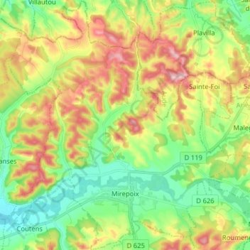
Name: Mirepoix topographic map, elevation, terrain.
Average elevation: 1,168 ft
Minimum elevation: 906 ft
Maximum elevation: 1,555 ft
La superficie de la commune est de 4 728 hectares ; son altitude varie de 276 à 462 mètres.
Other topographic maps
Click on a map to view its topography, its elevation and its terrain.