Geolocate

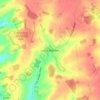
Braintree topographic map

Click on the map to display elevation.

About this map
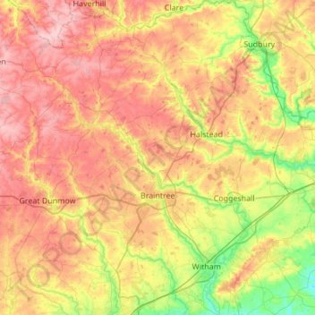
Name: Braintree topographic map, elevation, terrain.

Location: Braintree, Essex, England, United Kingdom (51.75041 0.37961 52.08703 0.78225)

Average elevation: 217 ft

Minimum elevation: 10 ft

Maximum elevation: 427 ft

Other topographic maps

Click on a map to view its topography, its elevation and its terrain.
Saffron Walden

United Kingdom > England > Essex > Uttlesford

Average elevation: 289 ft

Bulphan

United Kingdom > England > Essex

Average elevation: 33 ft

Winter Gardens

United Kingdom > England > Essex > Castle Point

Average elevation: 30 ft

Wickford

United Kingdom > England > Essex

Average elevation: 89 ft

Little Walden

United Kingdom > England > Essex > Uttlesford

Average elevation: 308 ft

Ramsden Heath

United Kingdom > England > Essex > Chelmsford

Average elevation: 190 ft

Hadleigh

United Kingdom > England > Essex > Castle Point

Average elevation: 95 ft

Stroud Green

United Kingdom > England > Essex > Rochford

Average elevation: 72 ft

Wivenhoe Woods

United Kingdom > England > Essex > Colchester > Wivenhoe > Rowhedge

Average elevation: 59 ft

Gear up for your next adventure:

☕Camping Coffee Makers - Enjoy premium coffee at the summit or campsite
🍳Camping Cook Set - Complete cookware for outdoor meals
🗃️Trail First Aid Kit - Essential kit for outdoor injuries and emergencies
🧺Microfiber Travel Towels - Compact and fast-drying towels for trail use
📖Nature Tracking Books - Learn to track wildlife and terrain

As an Amazon Associate, this site earns from qualifying purchases at no extra cost to you.