
Well topographic map
Interactive map
Click on the map to display elevation.
About this map
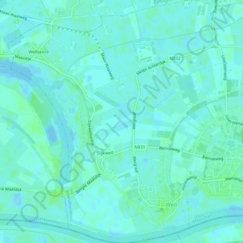
Name: Well topographic map, elevation, terrain.
Location: Well, Maasdriel, Gelderland, Nederland (51.74026 5.17367 51.76928 5.21517)
Average elevation: 10 ft
Minimum elevation: -13 ft
Maximum elevation: 23 ft
Other topographic maps
Click on a map to view its topography, its elevation and its terrain.
Velddriel
Nederland > Gelderland > Maasdriel
Velddriel, Maasdriel, Gelderland, Nederland
Average elevation: 10 ft
Kanaal van St. Andries
Nederland > Gelderland > Maasdriel
Kanaal van St. Andries, Maasdriel, Gelderland, Nederland, 6624KA, Nederland
Average elevation: 13 ft