
Leandro Valle topographic map
Interactive map
Click on the map to display elevation.
About this map
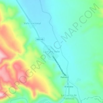
Name: Leandro Valle topographic map, elevation, terrain.
Location: Leandro Valle, Rodeo, Durango, México (25.02622 -104.50595 25.06622 -104.46595)
Average elevation: 4,780 ft
Minimum elevation: 4,485 ft
Maximum elevation: 5,472 ft