
Kalisch topographic map
Interactive map
Click on the map to display elevation.
About this map
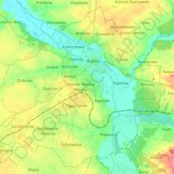
Name: Kalisch topographic map, elevation, terrain.
Location: Kalisch, Woiwodschaft Großpolen, 62-800, Polen (51.70079 17.99505 51.79385 18.15708)
Average elevation: 410 ft
Minimum elevation: 318 ft
Maximum elevation: 558 ft