Geolocate

Aruba topographic map

Click on the map to display elevation.

About this map

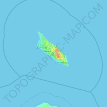
Name: Aruba topographic map, elevation, terrain.

Location: Aruba, Santa Cruz, Aruba, ARUBA, Netherlands (12.17030 -70.28098 12.81030 -69.64098)

Average elevation: 3 ft

Minimum elevation: 0 ft

Maximum elevation: 620 ft

Gear up for your next adventure:

🎁Geography Themed Gifts - Unique gift ideas for map lovers and geography enthusiasts
🧭Outdoor Navigation Book - Learn advanced navigation skills
🧥Waterproof Jacket for Hiking - Breathable and rugged rain jacket for outdoor excursions
🧴Hand Sanitizer - Keep hands clean while hiking
🪶Wildlife Field Guides - Learn animal tracking and species ID

As an Amazon Associate, this site earns from qualifying purchases at no extra cost to you.