
Lääne-Nigula vald topographic map
Interactive map
Click on the map to display elevation.
About this map
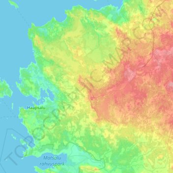
Name: Lääne-Nigula vald topographic map, elevation, terrain.
Location: Lääne-Nigula vald, Lääne maakond, Estonia (58.71595 23.35889 59.30436 24.19262)
Average elevation: 52 ft
Minimum elevation: -3 ft
Maximum elevation: 200 ft
Other topographic maps
Click on a map to view its topography, its elevation and its terrain.
Haapsalu
Haapsalu, Haapsalu linn, Lääne maakond, Estonia
Average elevation: 13 ft