
El Siete topographic map
Interactive map
Click on the map to display elevation.
About this map
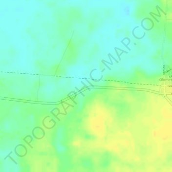
Name: El Siete topographic map, elevation, terrain.
Location: El Siete, Puerto Wilches, Yariguíes, Santander, Colombia (7.31814 -73.86322 7.33814 -73.84322)
Average elevation: 246 ft
Minimum elevation: 207 ft
Maximum elevation: 285 ft
Other topographic maps
Click on a map to view its topography, its elevation and its terrain.
Puerto Wilches
Colombia > Santander > Puerto Wilches > Puerto Wilches
Puerto Wilches, Yariguíes, Santander, Colombia
Average elevation: 217 ft
El Caballo
Colombia > Santander > Puerto Wilches > El Caballo
El Caballo, Puerto Wilches, Yariguíes, Santander, +57, Colombia
Average elevation: 236 ft
Boca De Limon
Colombia > Santander > Puerto Wilches
Boca De Limon, Puerto Wilches, Yariguíes, Santander, Colombia
Average elevation: 180 ft