
Roch topographic map
Interactive map
Click on the map to display elevation.
About this map
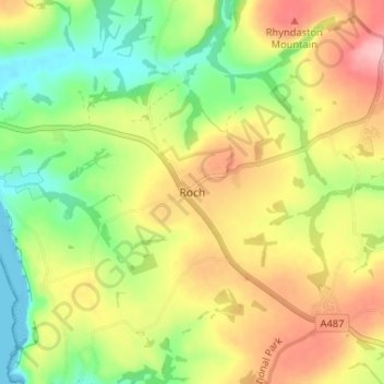
Name: Roch topographic map, elevation, terrain.
Location: Roch, Pembrokeshire, Pays de Galles, SA62 6FF, Royaume-Uni (51.82643 -5.10592 51.86643 -5.06592)
Average elevation: 226 ft
Minimum elevation: 0 ft
Maximum elevation: 486 ft
Other topographic maps
Click on a map to view its topography, its elevation and its terrain.
Fishguard
Royaume-Uni > Pays de Galles > Pembrokeshire
Fishguard, Pembrokeshire, Pays de Galles, SA65 9AN, Royaume-Uni
Average elevation: 249 ft
Stackpole
Royaume-Uni > Pays de Galles > Pembrokeshire
Stackpole, Pembrokeshire, Pays de Galles, SA71 5DA, Royaume-Uni
Average elevation: 125 ft