
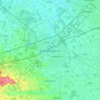
Rheda-Wiedenbrück topographic map
Interactive map
Click on the map to display elevation.
About this map
Name: Rheda-Wiedenbrück topographic map, elevation, terrain.
Average elevation: 262 ft
Minimum elevation: 210 ft
Maximum elevation: 515 ft
The length of the city border is 50,2 km, the highest elevation at 105m and the lowest point at 66m above mean sea level.
Other topographic maps
Click on a map to view its topography, its elevation and its terrain.
Harsewinkel
Germany > North Rhine-Westphalia > Kreis Gütersloh
Harsewinkel, Kreis Gütersloh, North Rhine-Westphalia, 33428, Germany
Average elevation: 226 ft