
Bockhorn topographic map
Interactive map
Click on the map to display elevation.
About this map
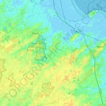
Name: Bockhorn topographic map, elevation, terrain.
Location: Bockhorn, Landkreis Friesland, Lower Saxony, 26345, Germany (53.30456 7.92952 53.46681 8.09962)
Average elevation: 23 ft
Minimum elevation: -13 ft
Maximum elevation: 66 ft
Other topographic maps
Click on a map to view its topography, its elevation and its terrain.
Jever
Germany > Lower Saxony > Landkreis Friesland
Jever, Landkreis Friesland, Lower Saxony, 26441, Germany
Average elevation: 10 ft