
Cilo Dağı topographic map
Interactive map
Click on the map to display elevation.
About this map
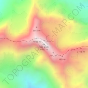
Name: Cilo Dağı topographic map, elevation, terrain.
Location: Cilo Dağı, Yüksekova, Hakkâri, Eastern Anatolia Region, Turkey (37.48568 44.00411 37.48578 44.00421)
Average elevation: 11,037 ft
Minimum elevation: 8,579 ft
Maximum elevation: 13,383 ft