
Bad Camberg topographic map
Interactive map
Click on the map to display elevation.
About this map
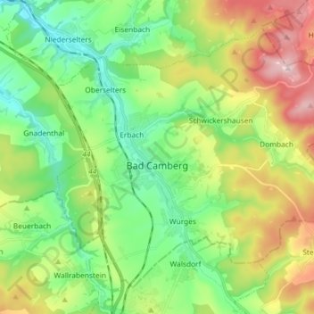
Name: Bad Camberg topographic map, elevation, terrain.
Location: Bad Camberg, Landkreis Limburg-Weilburg, Hesse, 65520, Allemagne (50.26365 8.22015 50.34034 8.36491)
Average elevation: 928 ft
Minimum elevation: 492 ft
Maximum elevation: 1,749 ft
Other topographic maps
Click on a map to view its topography, its elevation and its terrain.
Limbourg-sur-la-Lahn
Allemagne > Hesse > Landkreis Limburg-Weilburg
Limbourg-sur-la-Lahn, Landkreis Limburg-Weilburg, Hesse, Allemagne
Average elevation: 538 ft