
Thank you for supporting this site ❤️
Make a donation
Make a donation
Gear up for your next adventure:
As an Amazon Associate, this site earns from qualifying purchases at no extra cost to you.
Triund topographic map
Click on the map to display elevation.
Thank you for supporting this site ❤️
Make a donation
Make a donation
Gear up for your next adventure:
As an Amazon Associate, this site earns from qualifying purchases at no extra cost to you.
About this map
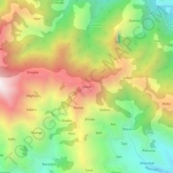
Name: Triund topographic map, elevation, terrain.
Location: Triund, Saluni, Chamba, Himachal Pradesh, 176320, India (32.70878 75.97099 32.74878 76.01099)
Average elevation: 6,312 ft
Minimum elevation: 4,449 ft
Maximum elevation: 8,537 ft
Thank you for supporting this site ❤️
Make a donation
Make a donation
Gear up for your next adventure:
As an Amazon Associate, this site earns from qualifying purchases at no extra cost to you.