
Minturn topographic map
Interactive map
Click on the map to display elevation.
About this map
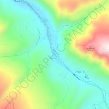
Name: Minturn topographic map, elevation, terrain.
Location: Minturn, Eagle County, Colorado, 81645, USA (39.56736 -106.44823 39.60795 -106.40626)
Average elevation: 8,612 ft
Minimum elevation: 7,746 ft
Maximum elevation: 10,292 ft