
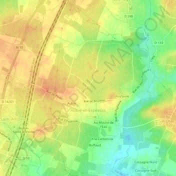
Aubie-et-Espessas topographic map
Interactive map
Click on the map to display elevation.
About this map
Name: Aubie-et-Espessas topographic map, elevation, terrain.
Average elevation: 125 ft
Minimum elevation: 43 ft
Maximum elevation: 184 ft
Other topographic maps
Click on a map to view its topography, its elevation and its terrain.
Cassagne-Nord
France > Nouvelle-Aquitaine > Gironde > Val de Virvée
Cassagne-Nord, Salignac, Val de Virvée, Blaye, Gironde, Nouvelle-Aquitaine, France métropolitaine, 33240, France
Average elevation: 112 ft
Saint-Antoine
France > Nouvelle-Aquitaine > Gironde > Val de Virvée
Saint-Antoine, Val de Virvée, Blaye, Gironde, Nouvelle-Aquitaine, France métropolitaine, 33240, France
Average elevation: 148 ft
Salignac
France > Nouvelle-Aquitaine > Gironde > Val de Virvée
Salignac, Val de Virvée, Blaye, Gironde, Nouvelle-Aquitaine, France métropolitaine, 33240, France
Average elevation: 138 ft