
Thank you for supporting this site ❤️
Make a donation
Make a donation
Gear up for your next adventure:
As an Amazon Associate, this site earns from qualifying purchases at no extra cost to you.
Lamu topographic map
Click on the map to display elevation.
Thank you for supporting this site ❤️
Make a donation
Make a donation
Gear up for your next adventure:
As an Amazon Associate, this site earns from qualifying purchases at no extra cost to you.
About this map
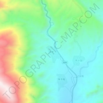
Name: Lamu topographic map, elevation, terrain.
Location: Lamu, Hualong Hui Autonomous County, Haidong, Qinghai, China (35.94520 102.28102 35.98520 102.32102)
Average elevation: 7,402 ft
Minimum elevation: 6,650 ft
Maximum elevation: 9,236 ft
Thank you for supporting this site ❤️
Make a donation
Make a donation
Gear up for your next adventure:
As an Amazon Associate, this site earns from qualifying purchases at no extra cost to you.