
Rivière des Outaouais topographic map
Interactive map
Click on the map to display elevation.
About this map
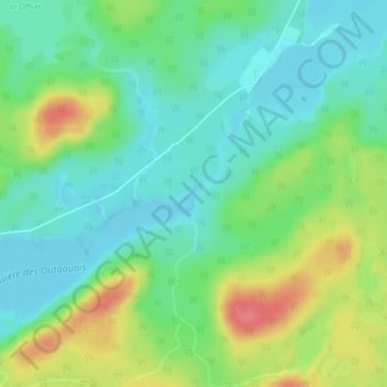
Name: Rivière des Outaouais topographic map, elevation, terrain.
Average elevation: 1,401 ft
Minimum elevation: 1,322 ft
Maximum elevation: 1,549 ft
Other topographic maps
Click on a map to view its topography, its elevation and its terrain.
Lac Sarazin
Canada > Québec > La Vallée-de-la-Gatineau > Lac-Moselle
Lac Sarazin, Lac-Moselle, La Vallée-de-la-Gatineau, Outaouais, Québec, Canada
Average elevation: 1,457 ft
Lac Capimitchigama
Canada > Québec > La Vallée-de-la-Gatineau > Lac-Moselle
Lac Capimitchigama, Lac-Moselle, La Vallée-de-la-Gatineau, Outaouais, Québec, Canada
Average elevation: 1,427 ft
Lac King
Canada > Québec > La Vallée-de-la-Gatineau > Lac-Moselle
Lac King, Lac-Moselle, La Vallée-de-la-Gatineau, Outaouais, Québec, Canada
Average elevation: 1,332 ft