
Dera Ghazi Khan topographic map
Interactive map
Click on the map to display elevation.
About this map
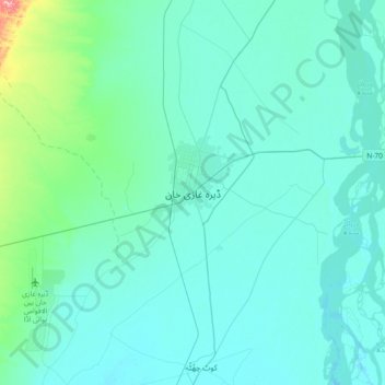
Name: Dera Ghazi Khan topographic map, elevation, terrain.
Location: Dera Ghazi Khan, Dera Ghazi Khan Tehsil, Punjab, Pakistan (29.87214 70.48011 30.19214 70.80011)
Average elevation: 427 ft
Minimum elevation: 361 ft
Maximum elevation: 1,014 ft