
Thank you for supporting this site ❤️
Make a donation
Make a donation
Gear up for your next adventure:
As an Amazon Associate, this site earns from qualifying purchases at no extra cost to you.
Dharali topographic map
Click on the map to display elevation.
Thank you for supporting this site ❤️
Make a donation
Make a donation
Gear up for your next adventure:
As an Amazon Associate, this site earns from qualifying purchases at no extra cost to you.
About this map
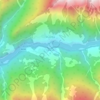
Name: Dharali topographic map, elevation, terrain.
Location: Dharali, Bhatwari, Uttarkashi district, Uttarakhand, India (31.01967 78.75984 31.05967 78.79984)
Average elevation: 9,721 ft
Minimum elevation: 8,173 ft
Maximum elevation: 12,740 ft
Thank you for supporting this site ❤️
Make a donation
Make a donation
Gear up for your next adventure:
As an Amazon Associate, this site earns from qualifying purchases at no extra cost to you.