
Hohenerxleben topographic map
Interactive map
Click on the map to display elevation.
About this map
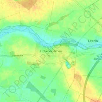
Name: Hohenerxleben topographic map, elevation, terrain.
Average elevation: 243 ft
Minimum elevation: 197 ft
Maximum elevation: 295 ft
Other topographic maps
Click on a map to view its topography, its elevation and its terrain.
Atzendorf
Deutschland > Sachsen-Anhalt > Salzlandkreis > Staßfurt
Atzendorf, Staßfurt, Salzlandkreis, Sachsen-Anhalt, 39443, Deutschland
Average elevation: 282 ft