
巴音沟牧场 topographic map
Interactive map
Click on the map to display elevation.
About this map
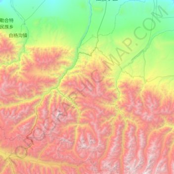
Name: 巴音沟牧场 topographic map, elevation, terrain.
Location: 巴音沟牧场, 乌苏市, Regierungsbezirk Tacheng, Xinjiang, China (43.57717 84.59404 44.31648 85.10983)
Average elevation: 8,143 ft
Minimum elevation: 2,087 ft
Maximum elevation: 17,008 ft