
Sidi Taïfour topographic map
Interactive map
Click on the map to display elevation.
About this map
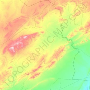
Name: Sidi Taïfour topographic map, elevation, terrain.
Location: Sidi Taïfour, daïra Boualem, El Bayadh, Algérie (33.34989 1.50048 33.90256 1.93671)
Average elevation: 4,108 ft
Minimum elevation: 2,887 ft
Maximum elevation: 6,342 ft