
El Allia topographic map
Interactive map
Click on the map to display elevation.
About this map
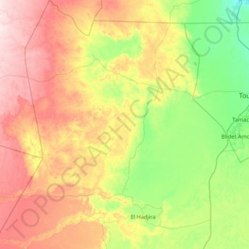
Name: El Allia topographic map, elevation, terrain.
Location: El Allia, Daïra El Hadjira, Ouargla, Algérie (32.47713 4.79002 33.49884 5.90098)
Average elevation: 554 ft
Minimum elevation: 138 ft
Maximum elevation: 1,325 ft
Other topographic maps
Click on a map to view its topography, its elevation and its terrain.