
Tyers topographic map
Interactive map
Click on the map to display elevation.
About this map
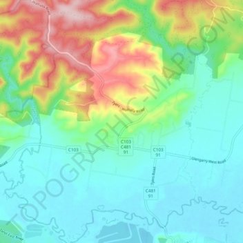
Name: Tyers topographic map, elevation, terrain.
Location: Tyers, Latrobe City, Victoria, Australia (-38.17865 146.42309 -38.10399 146.51559)
Average elevation: 328 ft
Minimum elevation: 79 ft
Maximum elevation: 958 ft