
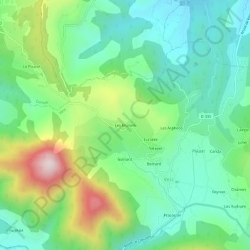
Les Brunets topographic map
Interactive map
Click on the map to display elevation.
About this map
Name: Les Brunets topographic map, elevation, terrain.
Average elevation: 2,182 ft
Minimum elevation: 1,572 ft
Maximum elevation: 3,576 ft
Other topographic maps
Click on a map to view its topography, its elevation and its terrain.
Les Chauvins
France > Auvergne-Rhône-Alpes > Drôme > Vesc
Les Chauvins, Vesc, Nyons, Drôme, Auvergne-Rhône-Alpes, France métropolitaine, 26220, France
Average elevation: 2,392 ft
La Viguière
France > Auvergne-Rhône-Alpes > Drôme > Vesc
La Viguière, Vesc, Nyons, Drôme, Auvergne-Rhône-Alpes, France métropolitaine, 26220, France
Average elevation: 2,129 ft
Bernard
France > Auvergne-Rhône-Alpes > Drôme > Vesc
Bernard, Vesc, Nyons, Drôme, Auvergne-Rhône-Alpes, France métropolitaine, 26220, France
Average elevation: 2,251 ft
Champbonnet
France > Auvergne-Rhône-Alpes > Drôme > Vesc
Champbonnet, Vesc, Nyons, Drôme, Auvergne-Rhône-Alpes, France métropolitaine, 26220, France
Average elevation: 2,871 ft