
Occoruro topographic map
Interactive map
Click on the map to display elevation.
About this map
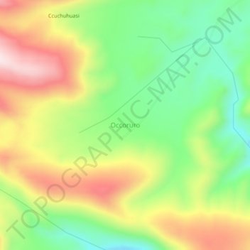
Name: Occoruro topographic map, elevation, terrain.
Location: Occoruro, Cotabambas, Apurímac, Perú (-13.93076 -72.24645 -13.89076 -72.20645)
Average elevation: 13,760 ft
Minimum elevation: 13,107 ft
Maximum elevation: 14,570 ft
Other topographic maps
Click on a map to view its topography, its elevation and its terrain.