
Grootdraai Dam topographic map
Interactive map
Click on the map to display elevation.
About this map
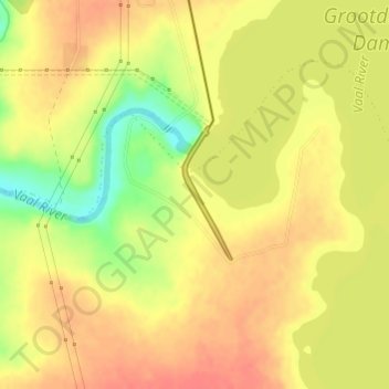
Name: Grootdraai Dam topographic map, elevation, terrain.
Average elevation: 5,082 ft
Minimum elevation: 4,967 ft
Maximum elevation: 5,141 ft
Other topographic maps
Click on a map to view its topography, its elevation and its terrain.
Grootdraai Dam
RSA > Mpumalanga > Lekwa Local Municipality
Grootdraai Dam, Bauman Street, Lekwa Ward 8, Lekwa Local Municipality, Gert Sibande, Mpumalanga, RSA
Average elevation: 5,154 ft