
Carmen topographic map
Interactive map
Click on the map to display elevation.
About this map
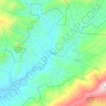
Name: Carmen topographic map, elevation, terrain.
Location: Carmen, Madison County, North Carolina, USA (35.98483 -82.66097 36.02483 -82.62097)
Average elevation: 2,776 ft
Minimum elevation: 2,110 ft
Maximum elevation: 4,485 ft