
Oued Derna topographic map
Interactive map
Click on the map to display elevation.
About this map
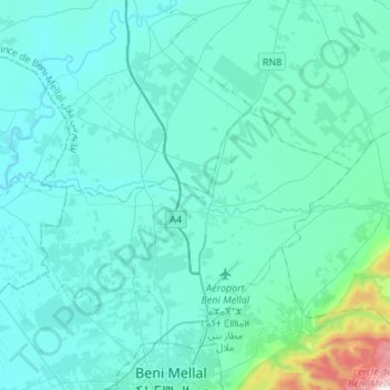
Name: Oued Derna topographic map, elevation, terrain.
Average elevation: 1,808 ft
Minimum elevation: 1,371 ft
Maximum elevation: 6,020 ft
Other topographic maps
Click on a map to view its topography, its elevation and its terrain.
Ouled Yaïch
Maroc > Béni Mellal-Khénifra > Ouled Yaïch
Ouled Yaïch, caïdat d'Ouled Yaïch, cercle de Béni-Mellal, Province de Beni Mellal, Béni Mellal-Khénifra, 23502, Maroc
Average elevation: 1,706 ft