
Prestonwood PID topographic map
Interactive map
Click on the map to display elevation.
About this map
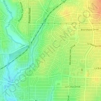
Name: Prestonwood PID topographic map, elevation, terrain.
Location: Prestonwood PID, Dallas, Dallas County, Texas, 75248, USA (32.96233 -96.80438 32.97617 -96.78880)
Average elevation: 614 ft
Minimum elevation: 554 ft
Maximum elevation: 676 ft
Other topographic maps
Click on a map to view its topography, its elevation and its terrain.
Webb Chapel Park
Webb Chapel Park, Dallas, Dallas County, Texas, USA
Average elevation: 528 ft