
长竹园乡 topographic map
Interactive map
Click on the map to display elevation.
About this map
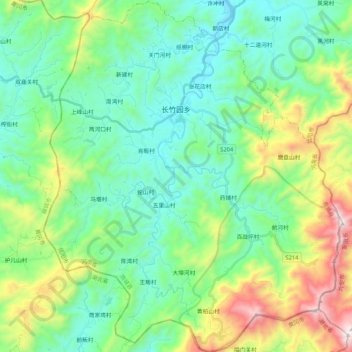
Name: 长竹园乡 topographic map, elevation, terrain.
Location: 长竹园乡, 商城县, 信阳市, 河南省, 中国 (31.38446 115.20308 31.56568 115.38345)
Average elevation: 1,434 ft
Minimum elevation: 400 ft
Maximum elevation: 4,308 ft
Other topographic maps
Click on a map to view its topography, its elevation and its terrain.