
Presa Chicoasén topographic map
Interactive map
Click on the map to display elevation.
About this map
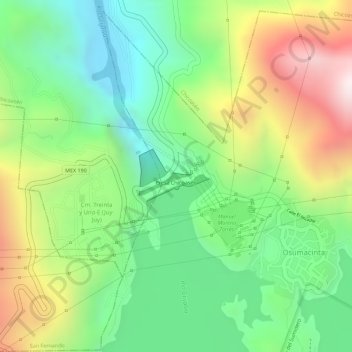
Name: Presa Chicoasén topographic map, elevation, terrain.
Location: Presa Chicoasén, Osumacinta, Chiapas, México (16.94079 -93.10270 16.94486 -93.09682)
Average elevation: 1,519 ft
Minimum elevation: 640 ft
Maximum elevation: 2,779 ft