
Cantón Heredia topographic map
Interactive map
Click on the map to display elevation.
About this map
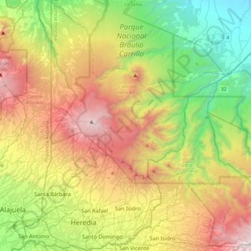
Name: Cantón Heredia topographic map, elevation, terrain.
Location: Cantón Heredia, Provincia Heredia, Costa Rica (9.95931 -84.16478 10.29849 -83.91918)
Average elevation: 4,219 ft
Minimum elevation: 354 ft
Maximum elevation: 9,977 ft