
Probolinggo topographic map
Interactive map
Click on the map to display elevation.
About this map
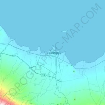
Name: Probolinggo topographic map, elevation, terrain.
Location: Probolinggo, East Java, 62719, Indonesia (-7.90415 113.05584 -7.58415 113.37584)
Average elevation: 187 ft
Minimum elevation: -7 ft
Maximum elevation: 4,006 ft
Other topographic maps
Click on a map to view its topography, its elevation and its terrain.
Kedopok
Indonesia > East Java > Probolinggo > Kedopok
Kedopok, Probolinggo, East Java, 67237, Indonesia
Average elevation: 95 ft